Camp Maps
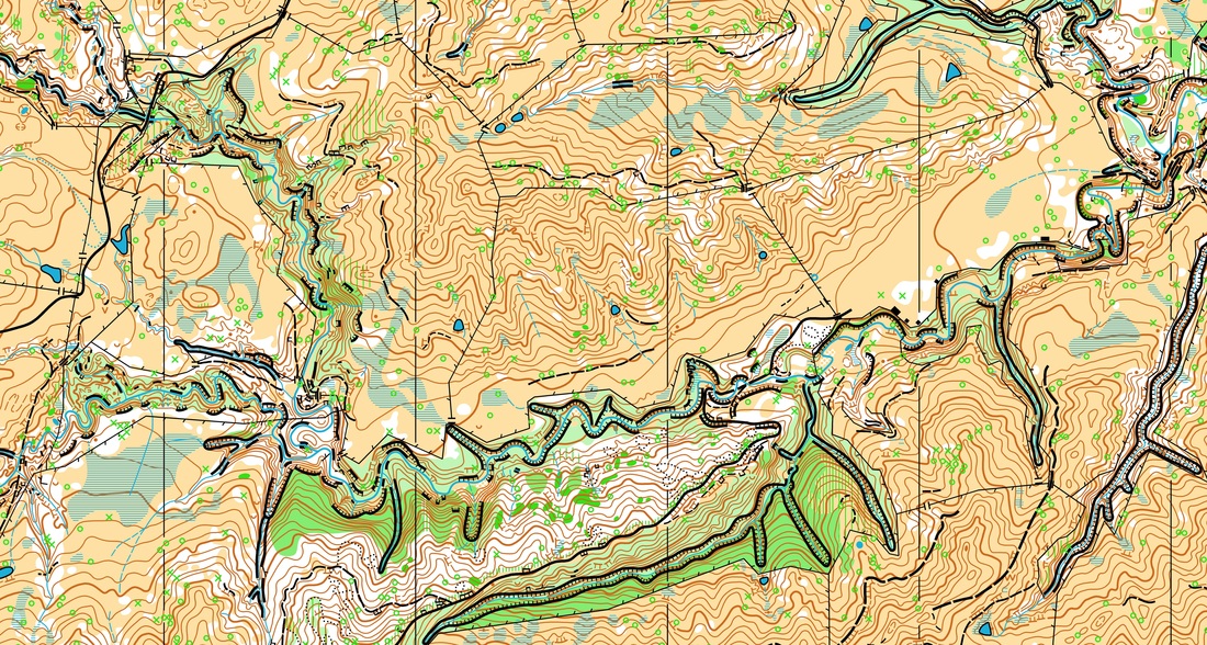
Whanawhana
Open farmland with a large amount of scattered native forest. Rolling to steep hills with lots of contour and rock/cliff detail. This map is in Hawkes Bay and is around a 70 minute drive from camp. Click on sample image for a bigger version. This is similar to the second half of WC 2013.
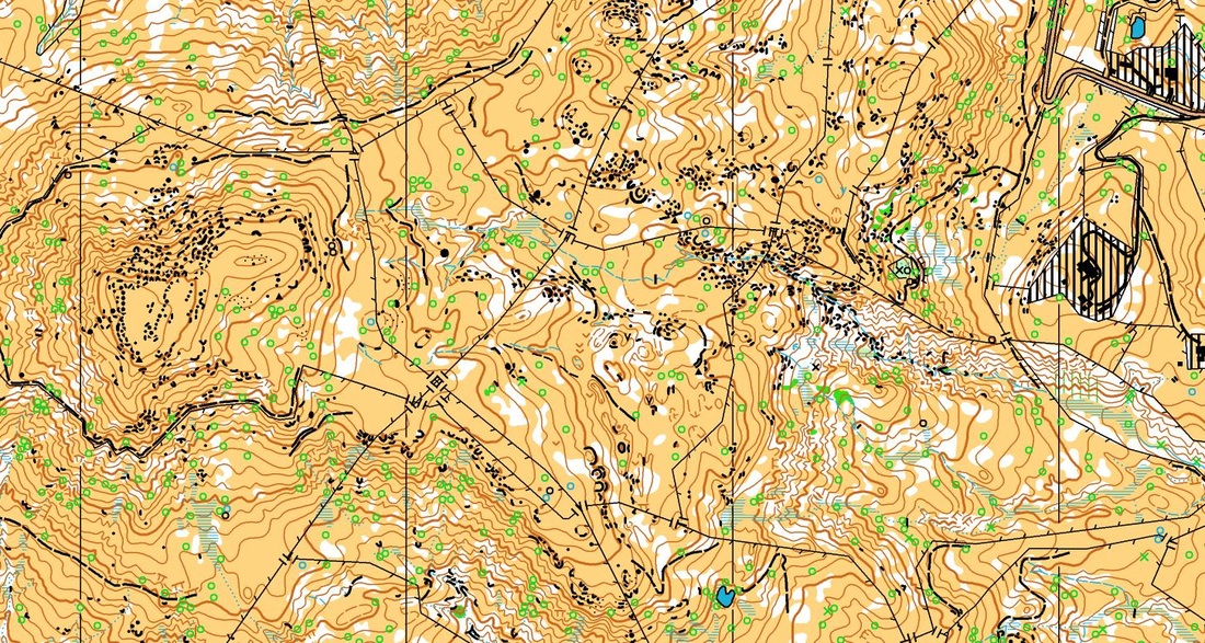
Smedley
Open farmland with a large amount of scattered native forest. Rolling to steep hills with a large amount of contour detail. The map also has tricky areas of gorge detail and a vast stream network. This map is in Hawkes Bay and is around a 70 minute drive from camp. Click on the sample image for a bigger version. This is similar to the second half of WC 2013.
Harakeke
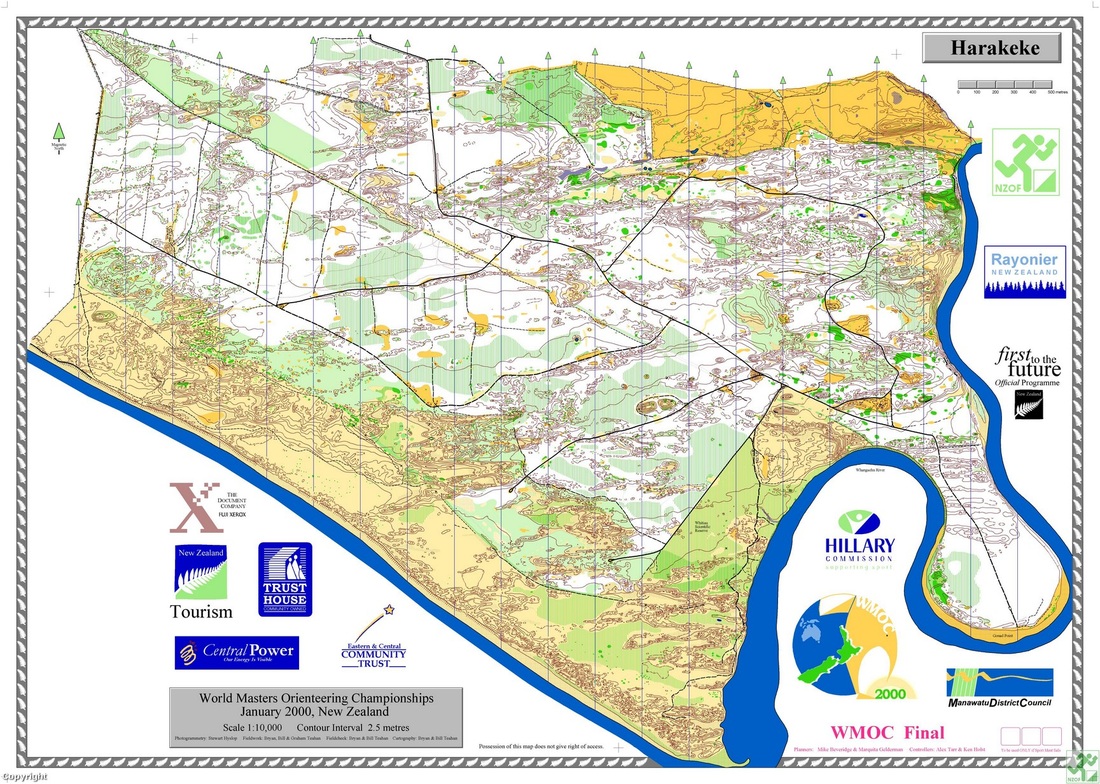
Pine Forest and coastal sand dune terrain. Ridges of sand dune contour detail and varying pine forest runnability. This map is close to Wanganui and is around a 60 minute drive from camp. Click on the sample image for a bigger version. This is similar to the first half of WC 2013.
Wanda

Pine forest and coastal sand dune. Areas of complex sand dune contour detal as well as rough and fast open farmland. This map is in the Manawatu region around 20 minutes from the camp. Click on the sample image for a bigger version. This is similar to the first half of WC 2013.
Massey University

Typical campus stlye sprint map with building detail. One corner of the map does contain some garden beds and bush which provides nice variation.
